Managing drought is key to preserving our groundwater
What is Drought?
Drought is defined as “a long period of abnormally low rainfall, especially one that adversely affects growing or living conditions”. Drought is actually a very common event, but the extent of drought conditions can very dramatically.
The impacts of a drought are typically divided into three categories:
1. Meteorologic drought (a period of lower than normal precipitation)
2. Soil moisture/vegetative drought (impacts on plants, wildlife and crops);
3. Hydrologic drought (resulting in lower stream flows and groundwater and reservoir levels.
How Texas prepares for and manages drought conditions
In the 1950s, Texas experienced what many refer to as the “drought of record”. The drought began in the late 1940s and ran through 1957. During this drought most of Texas received 30 – 50 percent less than its normal rainfall. As a result of the drought of record, the Texas Legislature created the Texas Water Development Board (TWDB).
The TWDB has an excellent website with a “drought” specific data http://waterdatafortexas.org/drought/. You can get local groundwater levels, reservoir levels, drought index maps and statewide information regarding droughts.
In 1999, the Texas Legislature created the Drought Preparedness Council, an inter-agency committee with the purpose of:
Monitoring and assessing drought and water supply conditions;
Advising the governor on significant drought conditions;
Recommending provision for inclusion in the state emergency management plan and state water plan;
Advising the Regional Water Planning Groups on drought related issues;
Ensuring effective coordination among state, local, and federal agencies in drought response planning; and
Reporting to the legislature any significant drought conditions within the state.
The Drought Preparedness Council, in times of significant drought meet often and prepares a Statewide Drought Situation Report which can be found here.
How is drought tracked?
A drought can be tracked in many different ways depending on the specific impact that applies. Some of the more common drought indexes are:
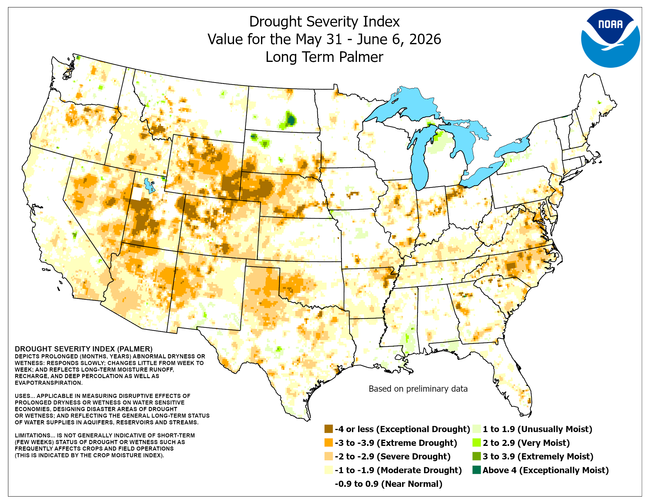
Palmer Drought Severity Index (a soil moisture index calibrated to specific regions and generally considered long term);
Crop Moisture Index (measures short term moisture conditions across major crop producing regions);
Keetch and Byram Drought Index (a moisture index specifically meant to assess potential wildfire conditions);
Standard Precipitation Index (based only on precipitation);
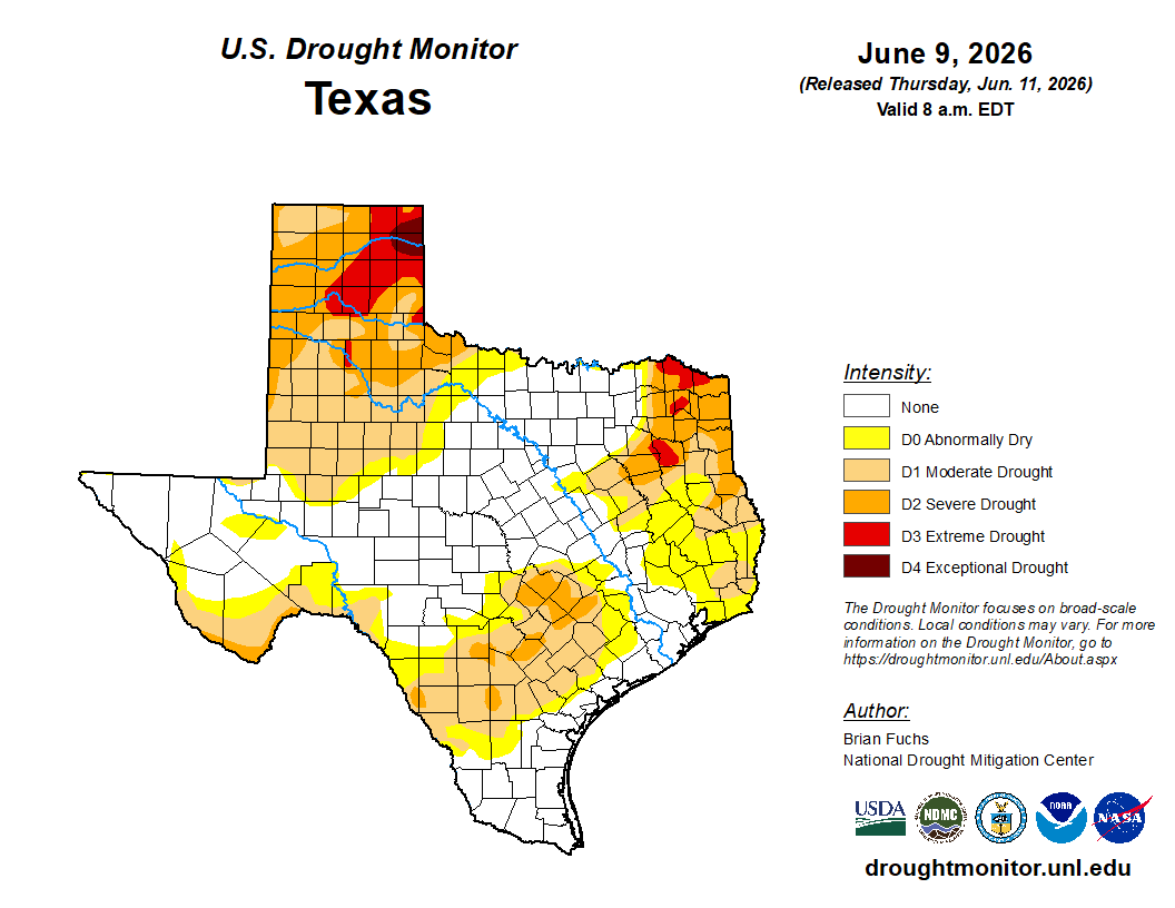
U.S. Drought Monitor Index (focuses on broad scale conditions).